Ontario Maps Home > Ontario Map Collection > Lake Superior Map - IMW
International Map of The World: Lake Superior: IMW-nl16
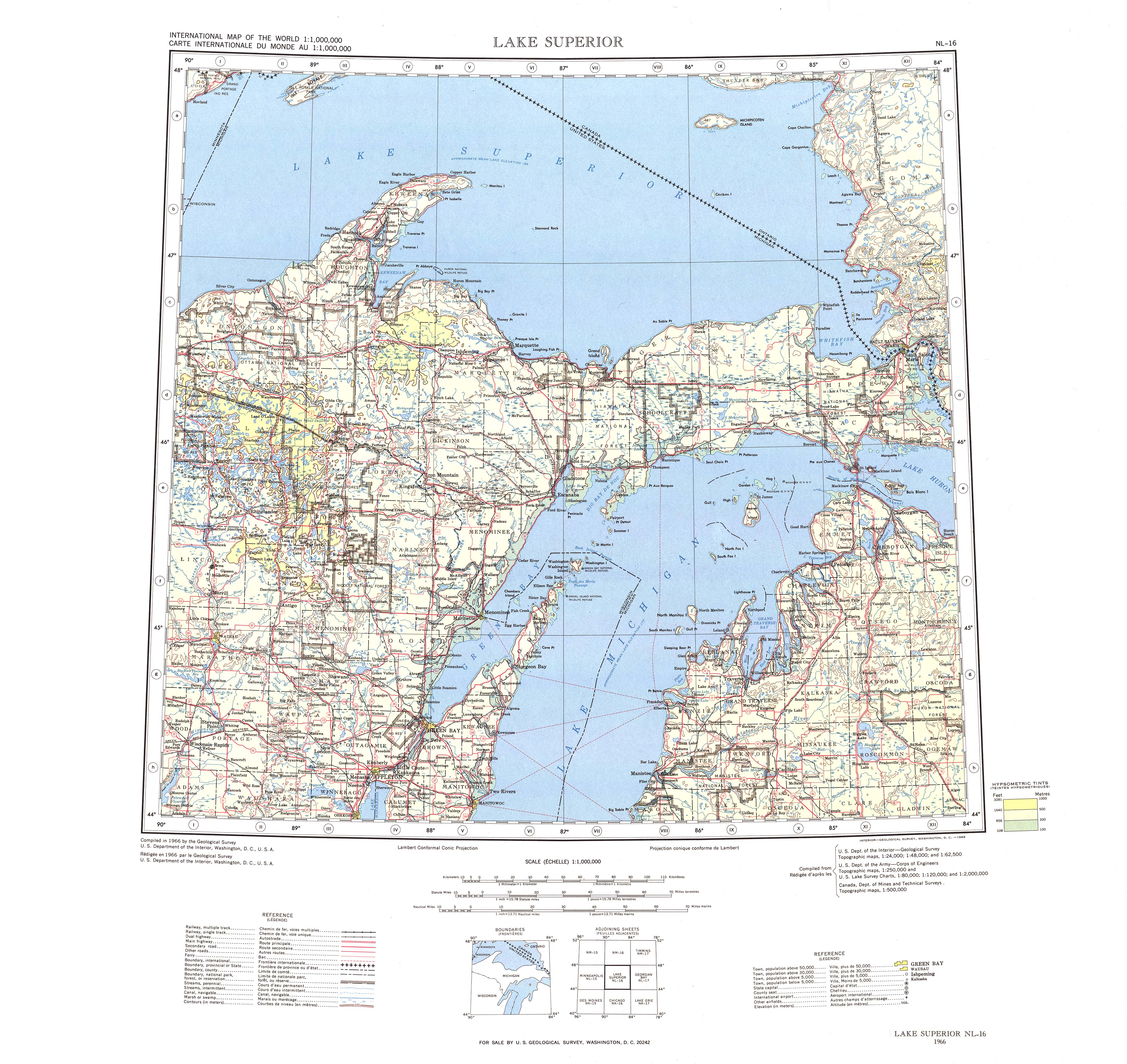
The above is a plain projection setting out the geography of this region with a basic selection of features.
You have permission to view the map and take advantage of it for a variety of purposes. Giving credit to this source would be helpful.
In the event you are hoping for help obtaining a map, a distinct kind of map, or are hoping for a good tailor-made cartographic design, you can email YellowMaps.
Purchase suitable custom maps from us. Our custom-made maps have a wholesome selection of map components, e.g.: routes, scale bar, UTM coordinates, bays, military area, sea features, hamlets, or road features, etc. Map types run from scientific to tourist, large-print to small-print, electoral district to school districts.
Good maps are correct, current, and not misleading. Finest cartography by YellowMaps.
To purchase paper maps, like road atlases, folded maps, or topo maps, you can dive into YellowMaps Map Store We have a collection of thousands and thousands maps.
A lot of our maps get printed on-demand. They are always available.
Back to Ontario map collection